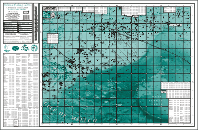

Over the past few years, Hilton's Fishing Charts and Atlases have become the Bible for serious offshore fishermen along the Northern Gulf of Mexico.
Using state-of-the-art 3-d imagery and seismic technology, Hilton has single-handedly transformed the fishing chart industry in this part of the world. The latest surface platform locations, wrecks, rocks, obstructions, and a view of the ocean bottom as if the water was removed, all combine to make Hilton's the "go-to" map.
____